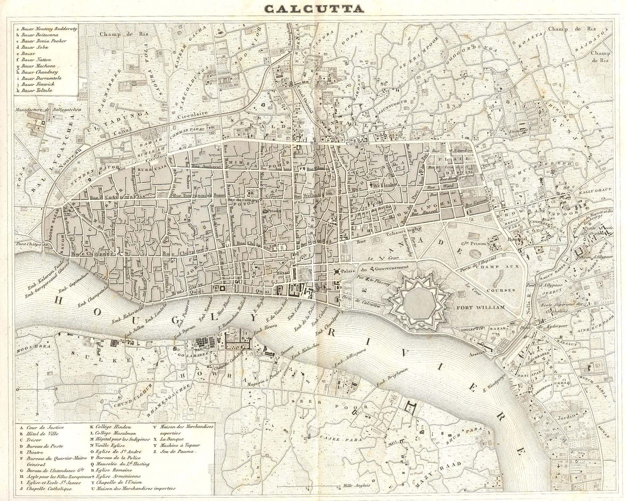
কলকাতা মানচিত্র, ১৮৩৯
a French map credited to Dufour and Benard, published by Rouard in 1839
Discover more from PURONOKOLKATA
Subscribe to get the latest posts sent to your email.

Calcutta: as she was – a visual documentation of socio-cultural ethos spanning over three centuries
কলকাতা মানচিত্র, ১৮৩৯
a French map credited to Dufour and Benard, published by Rouard in 1839
Subscribe to get the latest posts sent to your email.

