
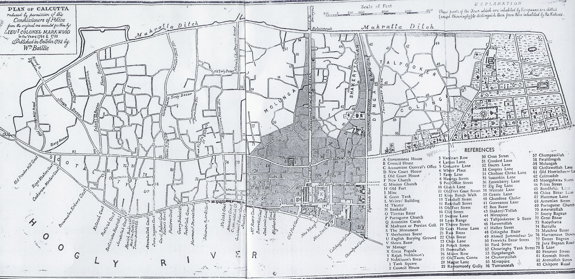
 পথ-নির্দেশক সহ কলকাতা মানচিত্র, মার্ক উড নির্মিত নকশা, ১৭৮৪-৮৫
Plan of Calcutta; reduced by permission of the Commissioners of Police from the original one executed for them by Lieu Colonel Mark Wood in the years 1784 & 1785.. The parts of the Town, which are inhabited by Europeans are dotted (except Chowringhy) to distinguish them from those inhabited by the Natives
Published in October 1792 by William Baillie
Discover more from PURONOKOLKATA
Subscribe to get the latest posts sent to your email.

