
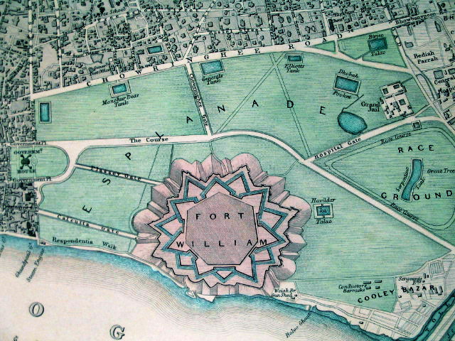
ফোর্ট উইলিয়াম মানচিত্র, গবিন্দপুর, কলকাতা, ১৮৪৪
Map of the New Fort William campus at Gobindapur, Calcutta. Designed by John Brohier, the fort was an irregular octagon with seven gates, surrounded by extensive defences. Its construction was completed in 1781 at a cost of approximately two million pounds. Above each of the gates was a residence for commanding officers. The towers in the print are those of the fort church of Saint Peter. The construction of the fort altered the entire urban plan of Calcutta and the city flourished and grew under its protective ramparts. Large areas of the jungle were cleared to provide a clear line of fire, and the resulting flat spaces were eventually filled by buildings.
Prepared by the Society for the Diffusion of Useful Knowledge, 1844


the Map is missing
LikeLike
Thanks. Corrected.
LikeLike